United States · Detailed regional profile
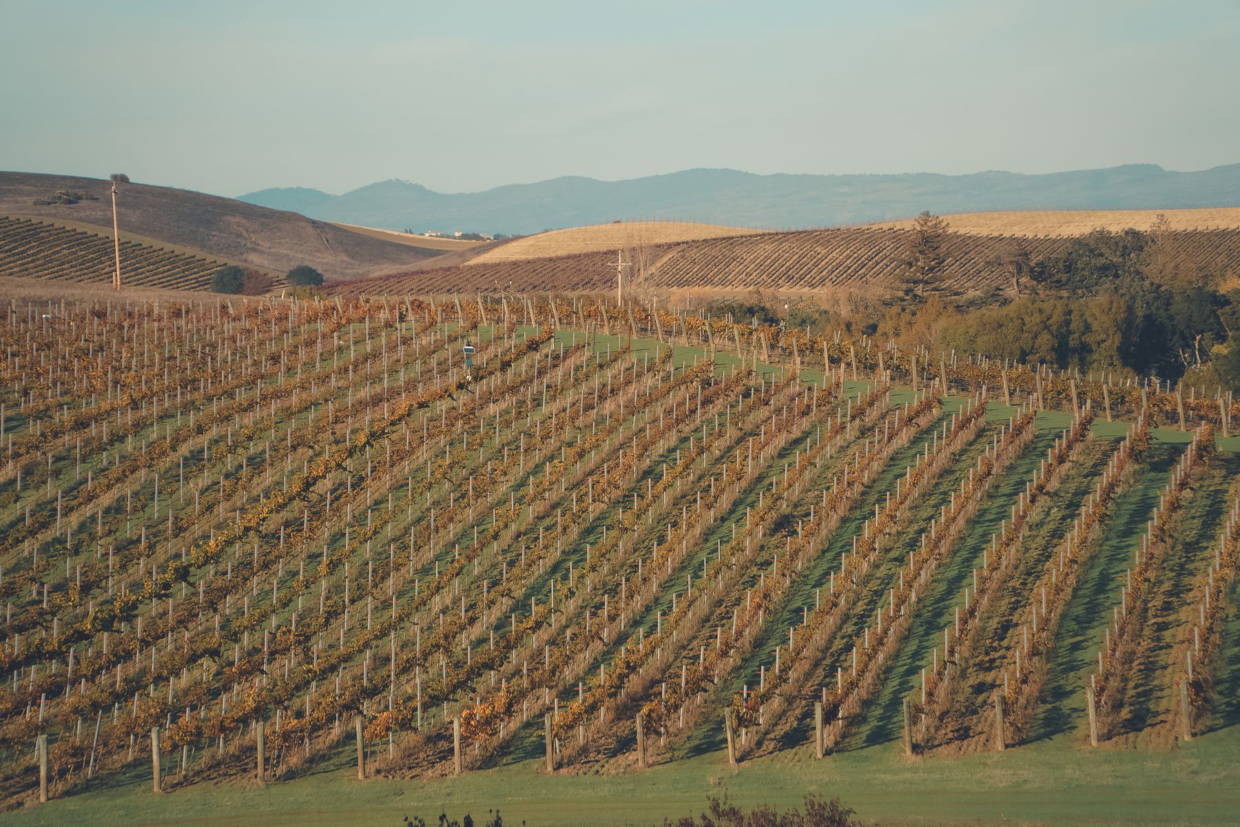
Napa Valley
Sign in to followA small California AVA known especially for Cabernet Sauvignon, with cooler conditions in the south and warmer sites farther north.
Summers are dry and warm, while marine air reaches parts of the valley. Heat, water stress, and harvest timing can all vary by site.
Climate comparisons use the 1991–2020 combined regional record · updated through Aug 20, 2026.
Current conditions
Observations through Aug 31, 2026 · 00:30 UTC
Temperature23.7°C
Dew Point12.1°C
Relative Humidity50%
24h Rainfall0.0 mmmodeled IFS total through Aug 29
NWS station average · 2 stations
Temperature, dew point, humidity, and wind are averaged using the same locations and weights as the historical record. The current temperature uses 100% of the configured regional weight.
- KAPC — Napa, Napa County Airport · 55% regional weight
- KSTS — Santa Rosa, Santa Rosa Sonoma County Airport · 45% regional weight
NOAA National Weather Service observations. Station readings are point measurements and may not represent every vineyard elevation or exposure.
Vintage explorer
Mean temperature18.3°C
Temperature anomaly-0.2°Cvs 1991-2020
Growing degree days2035base 10°C
Hot days17≥ 35°C
What stood out in 2009
Frost exposure can vary sharply from one site to the next.
Spring frost recorded · Low confidence
The regional record had 1 spring day(s) at or below 0°C.
Frost exposure can vary sharply from one site to the next.
How unusual was 2009?
The ranking compares vintages that meet the data-coverage threshold and use the same source, regional rules, and 1991-2020 baseline.
Growing-season temperature
14th coolest of 35 vintages Cooler than 21 of 34 other vintages 18.3°CGrowing-season rainfall
17th wettest of 35 vintages Wetter than 18 of 34 other vintages 204.6 mmHeat accumulation
12th lowest of 35 vintages Lower than 23 of 34 other vintages 2036 GDDHot days
7th most of 35 vintages More than 25 of 34 other vintages 17 days2009 month by month
Compared with 1991–2020
Follow heat accumulation, rainfall, frost exposure, and the region’s growing and harvest windows in calendar order.
Frost watch
Growing season
Harvest window
-
1–31 Frost watchGrowing seasonHeat accumulation
2009 65 GDDTypical 83 GDDRainfall
2009 70.3 mmTypical 111.5 mm- 2009 freezing days
- 1
- Typical
- 0.2
Drier than the typical month.
-
1–30 Frost watchGrowing seasonHeat accumulation
2009 124 GDDTypical 131 GDDRainfall
2009 18.5 mmTypical 48.4 mm- 2009 freezing days
- 0
- Typical
- 0.0
Drier than the typical month.
-
1–31 Frost watchGrowing seasonHeat accumulation
2009 250 GDDTypical 226 GDDRainfall
2009 50.6 mmTypical 29.5 mm- 2009 freezing days
- 0
- Typical
- 0.0
Wetter than the typical month.
-
1–30 Growing seasonHeat accumulation
2009 279 GDDTypical 315 GDDRainfall
2009 2.1 mmTypical 7.4 mmClose to the typical monthly pattern.
-
1–31 Growing seasonHeat accumulation
2009 357 GDDTypical 374 GDDRainfall
2009 0.1 mmTypical 0.3 mmClose to the typical monthly pattern.
-
1–31 Growing seasonHarvest windowHeat accumulation
2009 365 GDDTypical 372 GDDRainfall
2009 0.0 mmTypical 1.1 mmClose to the typical monthly pattern.
-
1–30 Growing seasonHarvest windowHeat accumulation
2009 360 GDDTypical 330 GDDRainfall
2009 2.8 mmTypical 2.8 mmClose to the typical monthly pattern.
-
1–31 Growing seasonHarvest windowHeat accumulation
2009 192 GDDTypical 232 GDDRainfall
2009 111.2 mmTypical 37.0 mmWetter than the typical month.
-
1–15 Growing seasonHarvest windowHeat accumulation
2009 45 GDDTypical 55 GDDRainfall
2009 6.7 mmTypical 30.6 mmDrier than the typical month.
View milestone calendar data as a table
| Month | 2009 GDD | Typical GDD | 2009 rainfall | Typical rainfall | 2009 freezing days | Typical freezing days |
|---|---|---|---|---|---|---|
| March 2009 | 65 GDD | 83 GDD | 70.3 mm | 111.5 mm | 1 | 0.2 |
| April 2009 | 124 GDD | 131 GDD | 18.5 mm | 48.4 mm | 0 | 0.0 |
| May 2009 | 250 GDD | 226 GDD | 50.6 mm | 29.5 mm | 0 | 0.0 |
| June 2009 | 279 GDD | 315 GDD | 2.1 mm | 7.4 mm | Outside frost window | Outside frost window |
| July 2009 | 357 GDD | 374 GDD | 0.1 mm | 0.3 mm | Outside frost window | Outside frost window |
| August 2009 | 365 GDD | 372 GDD | 0.0 mm | 1.1 mm | Outside frost window | Outside frost window |
| September 2009 | 360 GDD | 330 GDD | 2.8 mm | 2.8 mm | Outside frost window | Outside frost window |
| October 2009 | 192 GDD | 232 GDD | 111.2 mm | 37.0 mm | Outside frost window | Outside frost window |
| November 2009 | 45 GDD | 55 GDD | 6.7 mm | 30.6 mm | Outside frost window | Outside frost window |
Calendar data and method
Monthly values are weighted across every configured regional sample using stored Google ARCO ERA5 daily reanalysis. “Typical” is the mean monthly total across 30 baseline seasons. GDD is counted only inside the configured growing window; freezing days are counted only inside the frost-watch window; rainfall covers every displayed calendar day.
Selected-vintage coverage is 100%. Source rows were last retrieved Aug 20, 2026.
Replay the 2009 growing season
246 daily regional observations
Move through the season to follow temperature, rainfall, accumulated heat, and recorded weather events day by day.
Mean temperature
Daily rainfall
Season GDD
Season rainfall
No detected event on this date.
Replay data and method
Daily values are weighted across every configured regional sample using stored Google ARCO ERA5 reanalysis. Coverage is 100%. Source rows were last retrieved Aug 20, 2026.
Closest weather matches
These years had the most similar growing-season and harvest weather.
Closest match
2002
Most alike in Spring frost exposure and Growing degree days.
- Spring frost exposure
- the same: 0 days
- Growing degree days
- lower: 2 GDD
Largest difference: Growing-season precipitation — less rain
View 2002 →Second closest
2000
Most alike in Growing-season precipitation and Growing degree days.
- Growing-season precipitation
- more rain: 2.3 mm
- Growing degree days
- higher: 9 GDD
Largest difference: Spring frost exposure — fewer frost-exposure days
View 2000 →Third closest
1999
Most alike in Spring frost exposure and Growing-season precipitation.
- Spring frost exposure
- the same: 0 days
- Growing-season precipitation
- less rain: 2.8 mm
Largest difference: Harvest precipitation — less rain
View 1999 →
How similar years are calculated
Method analog-v1-2026-07 standardizes six weather measures across 34 complete ARCO ERA5 comparison years, then measures the distance between them. The calculation runs when the page is requested.
Measures used: Growing-season mean temperature (20%); Growing degree days (15%); Hot-day count (15%); Growing-season precipitation (20%); Harvest precipitation (20%); Spring frost exposure (10%).
Calculated distances: 2002 0.462; 2000 0.715; 1999 0.813.
View historical chart data as a table
| Year | Temperature anomaly | Rainfall anomaly | Hot days |
|---|---|---|---|
| 1991 | -0.6°C | +13 mm | 10 |
| 1992 | +0.7°C | -19 mm | 9 |
| 1993 | +0.1°C | +14 mm | 10 |
| 1994 | -0.6°C | +33 mm | 7 |
| 1995 | -0.4°C | +21 mm | 16 |
| 1996 | +0.2°C | +11 mm | 23 |
| 1997 | +0.8°C | -27 mm | 10 |
| 1998 | -1.0°C | +87 mm | 16 |
| 1999 | -0.6°C | -7 mm | 10 |
| 2000 | -0.2°C | -2 mm | 13 |
| 2001 | +0.6°C | -65 mm | 17 |
| 2002 | -0.2°C | -59 mm | 16 |
| 2003 | -0.1°C | +57 mm | 17 |
| 2004 | +0.3°C | -28 mm | 7 |
| 2005 | -0.5°C | +111 mm | 10 |
| 2006 | -0.2°C | +136 mm | 16 |
| 2007 | -0.1°C | -71 mm | 11 |
| 2008 | +0.1°C | -93 mm | 18 |
| 2009 | -0.2°C | -4 mm | 17 |
| 2010 | -1.0°C | +82 mm | 12 |
| 2011 | -1.1°C | +193 mm | 3 |
| 2012 | -0.5°C | +50 mm | 9 |
| 2013 | +0.3°C | -125 mm | 13 |
| 2014 | +0.8°C | -64 mm | 6 |
| 2015 | +0.7°C | -101 mm | 17 |
| 2016 | +0.3°C | +14 mm | 14 |
| 2017 | +0.8°C | +6 mm | 27 |
| 2018 | +0.2°C | -30 mm | 7 |
| 2019 | +0.4°C | -31 mm | 13 |
| 2020 | +0.9°C | -104 mm | 23 |
| 2021 | +0.3°C | +90 mm | 12 |
| 2022 | +0.5°C | -55 mm | 18 |
| 2023 | -0.6°C | -29 mm | 10 |
| 2024 | +0.8°C | -65 mm | 28 |
| 2025 | -0.0°C | -32 mm | 7 |
| 2026 | +0.5°C | -88 mm | 7 |
winter
9.1°C
-0.4°C vs baseline
355 mm rain · -105 mm
spring
14.7°C
+0.0°C vs baseline
139 mm rain · -50 mm
summer
20.9°C
-0.7°C vs baseline
2 mm rain · -7 mm
harvest
19.0°C
-0.2°C vs baseline
120 mm rain · +49 mm
Weather events
Periods that crossed one of the published regional thresholds, shown in date order.
Spring frost exposure
- Minimum temperature
- -0.1°C
- Duration
- 1 day
- Severe-freeze days
- 0 days
The regional model recorded freezing temperatures during spring.
Dry spell
- Duration
- 15 days
- Total rain
- 0.0 mm
- Daily cutoff
- 1.0 mm/day
Dry spell
- Duration
- 20 days
- Total rain
- 0.3 mm
- Daily cutoff
- 1.0 mm/day
Dry spell
- Duration
- 28 days
- Total rain
- 1.1 mm
- Daily cutoff
- 1.0 mm/day
Heat episode
- Peak temperature
- 36.0°C
- Duration
- 2 days
- Heat accumulation
- 30 GDD
Dry spell
- Duration
- 101 days
- Total rain
- 0.7 mm
- Daily cutoff
- 1.0 mm/day
Heat episode
- Peak temperature
- 38.1°C
- Duration
- 2 days
- Heat accumulation
- 33 GDD
Heat episode
- Peak temperature
- 36.7°C
- Duration
- 3 days
- Heat accumulation
- 46 GDD
Heat episode
- Peak temperature
- 37.4°C
- Duration
- 2 days
- Heat accumulation
- 34 GDD
Dry spell
- Duration
- 28 days
- Total rain
- 0.4 mm
- Daily cutoff
- 1.0 mm/day
Heat episode
- Peak temperature
- 37.8°C
- Duration
- 2 days
- Heat accumulation
- 32 GDD
Concentrated harvest rain
- Total rain
- 99.8 mm
- Highest 3-day total
- 99.4 mm
- Trigger threshold
- 20.0 mm
A large share of the season's rain fell during the harvest period.
Dry spell
- Duration
- 16 days
- Total rain
- 0.8 mm
- Daily cutoff
- 1.0 mm/day
How events are detected
Weather & Vines combined regional series; method event-timeline-v2-2026-07, rules napa-v2-2026-07. Source last updated Aug 1, 2026, calculated Aug 29, 2026. Each configured point must have at least 95.0% coverage.
1991–present
Climate change
Measured regional trends are shown separately from model projections. The observed record ends at the latest complete growing season shared by every published region.
Observed record
Historical trends, 1991–2025
Growing degree days changed +42.2 GDD per decade. The 95% interval is +10.8 to +73.7 GDD per decade, based on 35 eligible vintages.
Weighted median: 70% SSP2-4.5 · 15% SSP1-2.6 · 15% SSP3-7.0
Shaded central 80% model range using the same weights.
How it is measured: Across the March 15–November 15 growing season, each day's mean temperature above 10°C adds to the total; cooler days add zero.
Scroll horizontally to inspect the full timeline.
View annual growing degree days data
| Vintage | Growing degree days | Change from 1991–2020 |
|---|---|---|
| 1991 | 1962 GDD | -124 GDD |
| 1992 | 2259 GDD | +173 GDD |
| 1993 | 2089 GDD | +3 GDD |
| 1994 | 1945 GDD | -141 GDD |
| 1995 | 1988 GDD | -98 GDD |
| 1996 | 2140 GDD | +54 GDD |
| 1997 | 2272 GDD | +186 GDD |
| 1998 | 1848 GDD | -238 GDD |
| 1999 | 1942 GDD | -144 GDD |
| 2000 | 2044 GDD | -42 GDD |
| 2001 | 2231 GDD | +145 GDD |
| 2002 | 2034 GDD | -52 GDD |
| 2003 | 2080 GDD | -6 GDD |
| 2004 | 2144 GDD | +58 GDD |
| 2005 | 1952 GDD | -134 GDD |
| 2006 | 2037 GDD | -49 GDD |
| 2007 | 2064 GDD | -22 GDD |
| 2008 | 2116 GDD | +30 GDD |
| 2009 | 2036 GDD | -50 GDD |
| 2010 | 1842 GDD | -244 GDD |
| 2011 | 1824 GDD | -262 GDD |
| 2012 | 1976 GDD | -110 GDD |
| 2013 | 2141 GDD | +55 GDD |
| 2014 | 2278 GDD | +192 GDD |
| 2015 | 2252 GDD | +166 GDD |
| 2016 | 2139 GDD | +53 GDD |
| 2017 | 2281 GDD | +195 GDD |
| 2018 | 2156 GDD | +70 GDD |
| 2019 | 2184 GDD | +98 GDD |
| 2020 | 2325 GDD | +239 GDD |
| 2021 | 2151 GDD | +65 GDD |
| 2022 | 2212 GDD | +126 GDD |
| 2023 | 1966 GDD | -120 GDD |
| 2024 | 2292 GDD | +206 GDD |
| 2025 | 2077 GDD | -9 GDD |
- Growing-season mean temperature
- +0.17 °C per decade 95% interval +0.04 to +0.30
- Growing degree days
- +42.21 GDD per decade 95% interval +10.75 to +73.68
- Growing-season precipitation
- -15.39 mm per decade 95% interval -26.01 to -4.76
- Hot days
- +1.02 days per decade 95% interval -0.30 to +2.34
- Spring frost days
- +0.03 days per decade 95% interval -0.07 to +0.14
- Longest dry spell
- +7.97 days per decade 95% interval -1.34 to +17.29
Last Updated August 20, 2026
Model ensemble
Projected climate through 2075
Temperature changes are relative to each model’s 1991–2020 baseline. The table combines all three pathways, weighted 70% to SSP2-4.5 and 15% each to SSP1-2.6 and SSP3-7.0.
Scroll horizontally to compare all columns.
| Period | Weighted median | Weighted central 80% | Models per pathway |
|---|---|---|---|
| 2021-2040 | +0.9°C | +0.5 to +1.3°C | 25 |
| 2041-2060 | +1.3°C | +1.0 to +2.1°C | 25 |
| 2061-2075 | +1.8°C | +1.4 to +2.7°C | 25 |
How pathways are combined
For each period and percentile, Weather & Vines takes 70% of the SSP2-4.5 value, 15% of the SSP1-2.6 value, and 15% of the SSP3-7.0 value. Each pathway contains the same 25 models. The weights are an editorial view of the current trajectory, not scenario probabilities.
Last Updated June 29, 2025
Typical year · 1991–2020
When to visit
This calendar describes typical regional weather under the selected climate baseline. It is not a forecast for a future trip, and it does not account for crowds, lodging, events, or vineyard access.
Deterministic IFS forecast
Next ten days
Scroll horizontally to see all forecast dates.
| Date | Sun | Mon | Tue | Wed | Thu | Fri | Sat | Sun | Mon | Tue |
|---|---|---|---|---|---|---|---|---|---|---|
| High | 29°C | 23°C | 20°C | 21°C | 24°C | 26°C | 26°C | 29°C | 26°C | 26°C |
| Low | 12°C | 12°C | 12°C | 12°C | 12°C | 14°C | 12°C | 12°C | 17°C | 19°C |
| Rain | 0.0 mm | 0.0 mm | 0.1 mm | 0.0 mm | 0.0 mm | 0.0 mm | 0.0 mm | 0.0 mm | 0.5 mm | 0.8 mm |
Across the typical year: Late July has the warmest median afternoon high (30.7°C); Late December has the coolest (13.0°C). Wet days are most frequent in Late February (42%) and least frequent in Early July (0%). Ties are resolved by calendar order.
Afternoon highOvernight lowMiddle 50%
Scroll horizontally to inspect all 24 half-month periods.
Scroll horizontally to inspect all 24 half-month periods.
View all 24 periods as a table
Scroll horizontally to view all columns.
| Period | Afternoon high, median (middle 50%) | Overnight low, median (middle 50%) | Wet-day frequency | Period rain, median (middle 50%) |
|---|---|---|---|---|
| Jan 1–15 | 13.3°C (11.4–15.3°C) | 4.0°C (2.1–6.2°C) | 36% | 49.2 mm (8.9–99.9 mm) |
| Jan 16–31 | 14.0°C (12.4–16.6°C) | 4.5°C (2.6–6.8°C) | 40% | 48.6 mm (18.5–130.2 mm) |
| Feb 1–15 | 15.4°C (13.6–18.3°C) | 5.2°C (3.2–7.5°C) | 35% | 55.3 mm (15.1–107.5 mm) |
| Feb 16–29 | 15.1°C (12.6–18.8°C) | 5.4°C (3.3–7.1°C) | 42% | 70.1 mm (26.7–130.9 mm) |
| Mar 1–15 | 17.4°C (14.3–20.7°C) | 6.0°C (4.0–8.1°C) | 36% | 53.1 mm (13.9–79.5 mm) |
| Mar 16–31 | 18.4°C (15.5–22.2°C) | 6.8°C (4.8–8.5°C) | 33% | 24.2 mm (11.6–71.7 mm) |
| Apr 1–15 | 19.4°C (16.4–22.4°C) | 6.7°C (4.9–8.5°C) | 27% | 24.8 mm (10.5–55.7 mm) |
| Apr 16–30 | 21.9°C (19.0–26.0°C) | 8.3°C (6.5–10.0°C) | 18% | 13.0 mm (6.1–23.4 mm) |
| May 1–15 | 23.8°C (20.4–26.8°C) | 9.3°C (7.8–10.9°C) | 14% | 4.2 mm (0.7–21.7 mm) |
| May 16–31 | 25.0°C (21.9–28.5°C) | 10.3°C (9.0–11.9°C) | 13% | 3.1 mm (0.4–25.7 mm) |
| Jun 1–15 | 27.5°C (24.7–30.7°C) | 11.7°C (10.3–13.3°C) | 6% | 0.7 mm (0.0–3.2 mm) |
| Jun 16–30 | 29.5°C (27.0–32.4°C) | 12.5°C (11.2–14.1°C) | 3% | 0.0 mm (0.0–0.8 mm) |
| Jul 1–15 | 30.3°C (28.4–32.6°C) | 13.0°C (12.0–14.3°C) | 0% | 0.0 mm (0.0–0.0 mm) |
| Jul 16–31 | 30.7°C (28.2–32.7°C) | 13.5°C (12.3–14.7°C) | 0% | 0.0 mm (0.0–0.1 mm) |
| Aug 1–15 | 30.5°C (28.1–33.1°C) | 13.2°C (12.2–14.6°C) | 0% | 0.0 mm (0.0–0.1 mm) |
| Aug 16–31 | 30.0°C (28.1–32.8°C) | 13.1°C (12.1–14.2°C) | 1% | 0.0 mm (0.0–0.1 mm) |
| Sep 1–15 | 29.5°C (27.3–32.5°C) | 12.5°C (11.4–14.1°C) | 2% | 0.0 mm (0.0–0.3 mm) |
| Sep 16–30 | 29.0°C (26.2–31.8°C) | 12.1°C (10.9–13.4°C) | 4% | 0.2 mm (0.0–1.6 mm) |
| Oct 1–15 | 26.2°C (23.1–29.3°C) | 10.7°C (9.1–12.3°C) | 9% | 2.2 mm (0.0–17.9 mm) |
| Oct 16–31 | 23.4°C (20.6–26.6°C) | 9.6°C (7.9–11.0°C) | 16% | 11.6 mm (0.4–34.3 mm) |
| Nov 1–15 | 19.2°C (16.6–22.6°C) | 7.4°C (5.5–9.2°C) | 21% | 20.6 mm (6.5–46.7 mm) |
| Nov 16–30 | 16.2°C (14.1–18.3°C) | 5.5°C (3.7–7.8°C) | 30% | 29.7 mm (20.8–58.0 mm) |
| Dec 1–15 | 14.1°C (12.7–15.9°C) | 4.4°C (2.4–7.5°C) | 42% | 68.3 mm (22.1–123.0 mm) |
| Dec 16–31 | 13.0°C (11.4–15.1°C) | 3.5°C (1.8–5.5°C) | 35% | 53.8 mm (9.9–127.5 mm) |
Each year contributes to temperature or rain separately when at least 90% of that period’s days are present. A value is shown only when at least 80% of the baseline years qualify. February 29 is included in late February.
Historical climatology Last Updated August 20, 2026
Season to date
Growing season heat and rainfall
Mar 15–Aug 29, 2026
Growing degree days1455.9base 10°C
Growing-season rainfall120.8 mmweighted regional total
2026 season1991–2020 average
2026 season1991–2020 average
View growing-season accumulation data
| Date | Season GDD | 1991–2020 average GDD | Season rainfall | 1991–2020 average rainfall |
|---|---|---|---|---|
| 2026-03-15 | 8.8 | 3.2 | 0.0 mm | 4.1 mm |
| 2026-03-16 | 19.1 | 6.6 | 0.0 mm | 7.4 mm |
| 2026-03-17 | 29.9 | 10.1 | 0.0 mm | 9.8 mm |
| 2026-03-18 | 40.7 | 13.6 | 0.0 mm | 11.3 mm |
| 2026-03-19 | 51.9 | 17.0 | 0.0 mm | 13.5 mm |
| 2026-03-20 | 63.9 | 20.1 | 0.0 mm | 18.1 mm |
| 2026-03-21 | 75.0 | 23.0 | 0.0 mm | 21.1 mm |
| 2026-03-22 | 83.6 | 25.6 | 0.0 mm | 25.8 mm |
| 2026-03-23 | 91.5 | 28.0 | 0.0 mm | 30.4 mm |
| 2026-03-24 | 99.5 | 30.1 | 0.0 mm | 35.6 mm |
| 2026-03-25 | 106.4 | 32.2 | 0.0 mm | 39.8 mm |
| 2026-03-26 | 113.4 | 34.4 | 0.0 mm | 42.2 mm |
| 2026-03-27 | 121.9 | 37.0 | 0.0 mm | 44.7 mm |
| 2026-03-28 | 129.9 | 40.2 | 0.0 mm | 46.4 mm |
| 2026-03-29 | 139.4 | 43.8 | 0.0 mm | 48.1 mm |
| 2026-03-30 | 147.5 | 47.6 | 0.0 mm | 48.8 mm |
| 2026-03-31 | 152.5 | 51.4 | 6.2 mm | 51.7 mm |
| 2026-04-01 | 154.9 | 55.2 | 9.9 mm | 54.7 mm |
| 2026-04-02 | 156.0 | 59.1 | 12.7 mm | 56.0 mm |
| 2026-04-03 | 160.7 | 62.4 | 12.7 mm | 57.5 mm |
| 2026-04-04 | 166.9 | 65.4 | 12.7 mm | 60.3 mm |
| 2026-04-05 | 174.4 | 68.3 | 12.7 mm | 62.2 mm |
| 2026-04-06 | 180.7 | 71.4 | 12.7 mm | 64.6 mm |
| 2026-04-07 | 186.2 | 74.6 | 12.7 mm | 67.9 mm |
| 2026-04-08 | 193.1 | 77.4 | 12.8 mm | 70.3 mm |
| 2026-04-09 | 199.4 | 80.4 | 12.9 mm | 71.5 mm |
| 2026-04-10 | 203.9 | 84.1 | 24.5 mm | 72.7 mm |
| 2026-04-11 | 205.2 | 87.7 | 41.3 mm | 76.1 mm |
| 2026-04-12 | 205.5 | 91.5 | 55.3 mm | 80.8 mm |
| 2026-04-13 | 206.4 | 95.3 | 57.0 mm | 83.1 mm |
| 2026-04-14 | 208.0 | 99.1 | 57.0 mm | 83.6 mm |
| 2026-04-15 | 209.9 | 102.3 | 57.0 mm | 84.4 mm |
| 2026-04-16 | 213.0 | 106.1 | 57.0 mm | 86.2 mm |
| 2026-04-17 | 218.0 | 110.4 | 57.0 mm | 88.3 mm |
| 2026-04-18 | 222.7 | 114.7 | 57.0 mm | 89.2 mm |
| 2026-04-19 | 227.6 | 119.4 | 57.0 mm | 89.9 mm |
| 2026-04-20 | 229.9 | 124.4 | 67.3 mm | 91.2 mm |
| 2026-04-21 | 231.4 | 129.4 | 91.2 mm | 91.9 mm |
| 2026-04-22 | 232.8 | 134.8 | 99.6 mm | 93.1 mm |
| 2026-04-23 | 235.8 | 140.1 | 99.6 mm | 94.4 mm |
| 2026-04-24 | 239.5 | 145.6 | 99.6 mm | 95.5 mm |
| 2026-04-25 | 241.2 | 151.0 | 99.6 mm | 97.1 mm |
| 2026-04-26 | 242.6 | 156.8 | 99.7 mm | 97.6 mm |
| 2026-04-27 | 244.8 | 162.8 | 100.1 mm | 98.2 mm |
| 2026-04-28 | 248.1 | 168.9 | 100.1 mm | 99.2 mm |
| 2026-04-29 | 253.6 | 175.4 | 100.1 mm | 99.9 mm |
| 2026-04-30 | 260.4 | 182.2 | 100.1 mm | 100.1 mm |
| 2026-05-01 | 267.3 | 189.2 | 100.1 mm | 101.6 mm |
| 2026-05-02 | 272.2 | 196.1 | 100.1 mm | 102.6 mm |
| 2026-05-03 | 276.0 | 202.6 | 100.1 mm | 103.9 mm |
| 2026-05-04 | 278.1 | 208.9 | 102.1 mm | 104.7 mm |
| 2026-05-05 | 281.2 | 215.1 | 110.0 mm | 105.8 mm |
| 2026-05-06 | 287.4 | 221.3 | 110.0 mm | 106.3 mm |
| 2026-05-07 | 294.4 | 228.0 | 110.0 mm | 107.5 mm |
| 2026-05-08 | 301.7 | 234.9 | 110.0 mm | 108.4 mm |
| 2026-05-09 | 310.6 | 241.5 | 110.0 mm | 109.2 mm |
| 2026-05-10 | 319.3 | 248.3 | 110.0 mm | 109.7 mm |
| 2026-05-11 | 329.9 | 255.1 | 110.0 mm | 110.0 mm |
| 2026-05-12 | 338.8 | 261.8 | 110.0 mm | 110.9 mm |
| 2026-05-13 | 346.7 | 268.4 | 110.0 mm | 111.4 mm |
| 2026-05-14 | 355.4 | 275.3 | 110.0 mm | 112.0 mm |
| 2026-05-15 | 365.2 | 282.6 | 110.0 mm | 114.3 mm |
| 2026-05-16 | 373.8 | 289.8 | 110.0 mm | 116.4 mm |
| 2026-05-17 | 380.9 | 297.1 | 110.0 mm | 117.8 mm |
| 2026-05-18 | 390.6 | 304.5 | 110.0 mm | 120.3 mm |
| 2026-05-19 | 401.4 | 311.8 | 110.0 mm | 121.6 mm |
| 2026-05-20 | 412.4 | 319.0 | 110.0 mm | 122.2 mm |
| 2026-05-21 | 423.8 | 326.6 | 110.0 mm | 123.4 mm |
| 2026-05-22 | 432.5 | 334.4 | 110.0 mm | 123.6 mm |
| 2026-05-23 | 439.3 | 342.6 | 110.0 mm | 124.0 mm |
| 2026-05-24 | 445.5 | 350.5 | 110.0 mm | 124.6 mm |
| 2026-05-25 | 449.8 | 358.2 | 110.0 mm | 125.3 mm |
| 2026-05-26 | 454.4 | 365.5 | 110.7 mm | 125.9 mm |
| 2026-05-27 | 458.6 | 373.2 | 112.6 mm | 126.9 mm |
| 2026-05-28 | 463.6 | 381.3 | 119.4 mm | 127.9 mm |
| 2026-05-29 | 469.4 | 389.9 | 120.2 mm | 128.8 mm |
| 2026-05-30 | 476.1 | 398.6 | 120.2 mm | 129.1 mm |
| 2026-05-31 | 485.2 | 408.0 | 120.2 mm | 129.6 mm |
| 2026-06-01 | 496.1 | 417.8 | 120.2 mm | 129.8 mm |
| 2026-06-02 | 506.3 | 427.4 | 120.2 mm | 129.9 mm |
| 2026-06-03 | 517.5 | 436.9 | 120.2 mm | 130.2 mm |
| 2026-06-04 | 529.5 | 446.2 | 120.2 mm | 131.9 mm |
| 2026-06-05 | 542.5 | 455.3 | 120.2 mm | 132.3 mm |
| 2026-06-06 | 552.8 | 464.1 | 120.2 mm | 132.3 mm |
| 2026-06-07 | 561.3 | 473.1 | 120.2 mm | 132.4 mm |
| 2026-06-08 | 569.7 | 482.7 | 120.4 mm | 132.9 mm |
| 2026-06-09 | 579.6 | 492.7 | 120.4 mm | 133.0 mm |
| 2026-06-10 | 594.5 | 502.6 | 120.4 mm | 133.1 mm |
| 2026-06-11 | 612.8 | 512.7 | 120.4 mm | 133.2 mm |
| 2026-06-12 | 627.8 | 523.0 | 120.4 mm | 133.4 mm |
| 2026-06-13 | 641.0 | 533.6 | 120.4 mm | 133.4 mm |
| 2026-06-14 | 652.6 | 544.5 | 120.4 mm | 133.5 mm |
| 2026-06-15 | 663.8 | 554.9 | 120.4 mm | 133.8 mm |
| 2026-06-16 | 674.0 | 565.4 | 120.4 mm | 134.3 mm |
| 2026-06-17 | 683.6 | 576.2 | 120.4 mm | 134.5 mm |
| 2026-06-18 | 691.7 | 587.2 | 120.4 mm | 134.6 mm |
| 2026-06-19 | 699.3 | 598.3 | 120.4 mm | 134.6 mm |
| 2026-06-20 | 707.7 | 609.6 | 120.4 mm | 134.6 mm |
| 2026-06-21 | 716.9 | 620.8 | 120.4 mm | 134.6 mm |
| 2026-06-22 | 726.3 | 632.2 | 120.4 mm | 134.6 mm |
| 2026-06-23 | 735.4 | 643.4 | 120.4 mm | 134.6 mm |
| 2026-06-24 | 744.1 | 654.5 | 120.4 mm | 134.7 mm |
| 2026-06-25 | 753.2 | 665.7 | 120.4 mm | 135.1 mm |
| 2026-06-26 | 762.5 | 676.9 | 120.5 mm | 135.2 mm |
| 2026-06-27 | 771.4 | 688.3 | 120.5 mm | 135.3 mm |
| 2026-06-28 | 780.9 | 699.7 | 120.5 mm | 136.3 mm |
| 2026-06-29 | 791.4 | 711.2 | 120.5 mm | 136.9 mm |
| 2026-06-30 | 801.7 | 723.3 | 120.5 mm | 137.1 mm |
| 2026-07-01 | 810.9 | 735.4 | 120.5 mm | 137.1 mm |
| 2026-07-02 | 819.8 | 747.3 | 120.5 mm | 137.1 mm |
| 2026-07-03 | 829.7 | 759.0 | 120.5 mm | 137.1 mm |
| 2026-07-04 | 840.3 | 771.0 | 120.5 mm | 137.1 mm |
| 2026-07-05 | 849.7 | 782.7 | 120.5 mm | 137.1 mm |
| 2026-07-06 | 858.4 | 794.4 | 120.5 mm | 137.1 mm |
| 2026-07-07 | 866.8 | 806.1 | 120.5 mm | 137.1 mm |
| 2026-07-08 | 876.0 | 818.2 | 120.5 mm | 137.1 mm |
| 2026-07-09 | 887.9 | 830.2 | 120.5 mm | 137.1 mm |
| 2026-07-10 | 898.9 | 842.0 | 120.5 mm | 137.2 mm |
| 2026-07-11 | 909.7 | 853.6 | 120.5 mm | 137.2 mm |
| 2026-07-12 | 923.2 | 865.4 | 120.5 mm | 137.2 mm |
| 2026-07-13 | 938.2 | 877.9 | 120.5 mm | 137.2 mm |
| 2026-07-14 | 954.6 | 890.3 | 120.5 mm | 137.2 mm |
| 2026-07-15 | 971.6 | 902.6 | 120.5 mm | 137.2 mm |
| 2026-07-16 | 985.3 | 914.5 | 120.5 mm | 137.2 mm |
| 2026-07-17 | 995.9 | 926.4 | 120.5 mm | 137.2 mm |
| 2026-07-18 | 1006.5 | 938.4 | 120.5 mm | 137.3 mm |
| 2026-07-19 | 1017.3 | 950.5 | 120.5 mm | 137.3 mm |
| 2026-07-20 | 1028.7 | 962.4 | 120.6 mm | 137.3 mm |
| 2026-07-21 | 1043.9 | 974.2 | 120.6 mm | 137.3 mm |
| 2026-07-22 | 1056.0 | 986.4 | 120.6 mm | 137.3 mm |
| 2026-07-23 | 1067.4 | 998.8 | 120.6 mm | 137.3 mm |
| 2026-07-24 | 1079.6 | 1011.1 | 120.6 mm | 137.3 mm |
| 2026-07-25 | 1091.9 | 1023.5 | 120.6 mm | 137.3 mm |
| 2026-07-26 | 1104.2 | 1036.1 | 120.6 mm | 137.3 mm |
| 2026-07-27 | 1115.9 | 1048.7 | 120.6 mm | 137.3 mm |
| 2026-07-28 | 1128.4 | 1061.1 | 120.6 mm | 137.3 mm |
| 2026-07-29 | 1141.5 | 1073.1 | 120.6 mm | 137.3 mm |
| 2026-07-30 | 1154.5 | 1085.3 | 120.6 mm | 137.3 mm |
| 2026-07-31 | 1167.7 | 1097.5 | 120.6 mm | 137.4 mm |
| 2026-08-01 | 1183.3 | 1109.8 | 120.6 mm | 137.4 mm |
| 2026-08-02 | 1199.7 | 1122.2 | 120.6 mm | 137.4 mm |
| 2026-08-03 | 1216.2 | 1134.4 | 120.6 mm | 137.4 mm |
| 2026-08-04 | 1230.4 | 1146.1 | 120.6 mm | 137.4 mm |
| 2026-08-05 | 1243.1 | 1157.3 | 120.6 mm | 137.4 mm |
| 2026-08-06 | 1255.7 | 1168.7 | 120.6 mm | 137.4 mm |
| 2026-08-07 | 1269.2 | 1180.2 | 120.6 mm | 137.4 mm |
| 2026-08-08 | 1282.9 | 1192.1 | 120.6 mm | 137.4 mm |
| 2026-08-09 | 1297.8 | 1204.3 | 120.6 mm | 137.4 mm |
| 2026-08-10 | 1310.1 | 1216.5 | 120.6 mm | 137.4 mm |
| 2026-08-11 | 1321.1 | 1228.8 | 120.6 mm | 137.4 mm |
| 2026-08-12 | 1330.9 | 1241.3 | 120.6 mm | 137.4 mm |
| 2026-08-13 | 1338.6 | 1254.0 | 120.7 mm | 137.5 mm |
| 2026-08-14 | 1347.5 | 1266.6 | 120.7 mm | 137.5 mm |
| 2026-08-15 | 1357.2 | 1279.0 | 120.7 mm | 137.5 mm |
| 2026-08-16 | 1368.5 | 1291.8 | 120.7 mm | 137.5 mm |
| 2026-08-17 | 1380.7 | 1304.1 | 120.7 mm | 137.6 mm |
| 2026-08-18 | 1393.3 | 1316.0 | 120.7 mm | 137.6 mm |
| 2026-08-19 | 1406.0 | 1327.4 | 120.7 mm | 137.6 mm |
| 2026-08-20 | 1417.5 | 1338.4 | 120.7 mm | 138.1 mm |
| 2026-08-21 | 1429.4 | 1349.9 | 120.8 mm | 138.1 mm |
| 2026-08-22 | 1442.0 | 1361.6 | 120.8 mm | 138.3 mm |
| 2026-08-23 | 1455.9 | 1373.4 | 120.8 mm | 138.3 mm |
Forecast outlook
ECMWF IFS 0.25° via Herbie · run Aug 30, 2026 at 00:00 UTC
10-day totals compared with the 1991–2020 combined regional record
- GDD accumulation
- 87 GDDvs 119 GDD average
- Total rainfall
- 1.5 mmvs 0.2 mm average
No unusually hot or wet period stands out in the short-range forecast.
Sun8/30
29°Cavg 30°C
12°Cavg 13°C
+10 GDD
0.0 mm
Mon8/31
23°Cavg 30°C
12°Cavg 13°C
+6 GDD
0.0 mm
Tue9/1
20°Cavg 31°C
12°Cavg 13°C
+5 GDD
0.1 mm
Wed9/2
21°Cavg 31°C
12°Cavg 13°C
+6 GDD
0.0 mm
Thu9/3
24°Cavg 31°C
12°Cavg 13°C
+7 GDD
0.0 mm
Fri9/4
26°Cavg 30°C
14°Cavg 13°C
+8 GDD
0.0 mm
Sat9/5
26°Cavg 31°C
12°Cavg 13°C
+9 GDD
0.0 mm
Sun9/6
29°Cavg 31°C
12°Cavg 13°C
+12 GDD
0.0 mm
Mon9/7
26°Cavg 31°C
17°Cavg 13°C
+12 GDD
0.5 mm
Tue9/8
26°Cavg 30°C
19°Cavg 13°C
+12 GDD
0.8 mm
Data and methods
Show data sources and model assumptions
Current temperature, dew point, humidity, and wind use geographically weighted NWS station observations. The 24-hour rain total and 10-day outlook use the 00 UTC deterministic ECMWF IFS 0.25° public forecast retrieved directly with Herbie. Historical temperature and rain combine qualifying GHCN-D stations with ERA5 by geographic area; a missing station day uses the nearest ERA5 value for that station's area. Climate comparisons use 1991–2020.
Forecast comparisons use the 1991–2020 combined regional daily record. Daily high and low averages use the matching date; rainfall and GDD sum the same calendar dates as the forecast period.
This service is based on data and products of the European Centre for Medium-Range Weather Forecasts (ECMWF). Weather & Vines subsets, converts, and regionally weights the forecast fields. ECMWF data are published under CC BY 4.0. ECMWF accepts no liability for errors, omissions, availability, loss, or damage arising from their use.
Climate projections use NASA NEX-GDDP-CMIP6 v2.0, accessed August 23, 2026, with 25 models. Weather & Vines subsets and aggregates the source fields. Source files and derived projection data are under CC BY-SA 4.0; the full roster and limitations are listed in the climate atlas methods.
The Napa Valley model uses a March 15–November 15 growing season, base 10°C GDD, and an operational hot-day marker of 35°C.
- Napa Valley Vintners: grape life cycle
- UC Davis: history of the UC grape and wine program and the origin of the Winkler zone approach
- WSU Viticulture & Enology: growing degree days and season heat accumulation
- Penn State Extension: spring frost and freeze damage
The historical series uses 4 ERA5 locations, 13 temperature stations, and 12 rain stations. Interpretation confidence: high. Geometry confidence: authoritative. Rules: napa-v2-2026-07.